Day 12 – Ankarana

We awoke early in the morning to have breakfast and prepare for our excursion leaving at 7:30 AM.  The weather was looking good for our trip to the Ankarana Nature Reserve to see some wildlife and unusual land formations.  Our driver picked us up on time, and we set out for Ankarana, about 130 km south of Antsiranana.

After stopping to pick up our picnic lunch, before leaving we had to steer around a goat that had decided to sit down in front of the car.

IMG_6087

Continuing down the road, we again passed through some flooded streets in town that had still not been cleared from the cyclone a few days earlier.  We had to drive through the water pictured below.

IMG_6090

IMG_6091

We then headed south out of town, along RN6.  I took photos along the way, and have posted a few of them below.

RN6 heading south out of Antsiranana…

IMG_6094

One of the many small mountains along the way…

IMG_6096

“Zebu crossing” sign…  We don’t have these back in Canada!
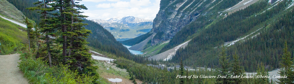
IMG_6097

Herding geese?

IMG_6105

One of the many rivers we would cross, and there were a lot of them…

IMG_6109

IMG_6110

Eating and drinking fresh coconut at the side of the road…  It’s really good!

IMG_6118

Red cliffs along the road…

IMG_6120

Chameleon we nearly squished on the road…

IMG_6123

Sapphire village along the way.  Apparently the area is rich with sapphires and every roadside stand is trading them…

IMG_6132

We arrived at Ankarana National Park where we met our park guide.  Guides are mandatory in the park, and for good reason–It would be very easy to get lost or hurt without one.  This nature reserve is very large, 18,255 ha, and many visitors here hike for 30 or 40 km while camping over several days.  We would only be hiking for a few hours.  Shown below is the park entrance.

IMG_6133

Our guide was very knowledgeable, and had studied botany in university in Madagascar, so he could tell us everything about nearly everything we saw here.  Fortunately, our guide was also the only guide around who spoke English, as well as French and Malagasy.  Here are some photos of our journey through the reserve.

A millipede moving along the ground…

IMG_6145

Moving over some loose rocks…

IMG_6151

An orange crab with purple legs…

IMG_6154

The white things that look like flowers are actually insects…

IMG_6155

Look very close to see the lemur in the tree, centre of photo.  This is one of ten species of lemurs found in the park, and we would see four of them before the day is over.

IMG_6157

Parrots in the trees…

IMG_6163

After hiking a bit through the forest, we would now climb up to see the Tsingy, which is a very unusual rock formation.  These a sharp spiny rock formations, and I’m sure it would hurt like hell if you fell on them.  Here we are starting to climb up.

IMG_6156

On top of the Tsingy…

IMG_6172

IMG_6175

IMG_6176

Tsingy close up with water pooled inside…

IMG_6180

IMG_6182

IMG_6184

IMG_6185

Very unusual tree that keeps water inside this bulge…

IMG_6188

More Tsingy close up…

IMG_6189

Holy shit it’s hot here!

IMG_6190

Watch your step, it’s a long way down…

IMG_6192

Dave and Nadine on top of the Tsingy…

IMG_6193

Dave walking very carefully on the Tsingy with our guide in the background.

IMG_6204

More Tsingy.  These rocks are damn sharp.

IMG_6205

IMG_6206

Climbing back down.  Fat people would have considerable difficulty.

IMG_6207

Still climbing down…

IMG_6208

And we’re still climbing down…

IMG_6211

A few lemurs in the trees…

IMG_6215

More lemurs…

IMG_6218

Another lemur…

IMG_6219

Below are a couple of short video climbs of the lemurs in the trees.

After a quick break watching the lemurs, it’s back to climbing down toward the bat cave.

IMG_6222

Holy crap!  Are we going to have to climb back up again?

IMG_6224

IMG_6225

OK.  I think we’ve finally made it to the bottom!

IMG_6226

At the entrance to the bat cave…

IMG_6228

We entered the bat cave, but didn’t go very far.  It was really muddy in there.  Supposedly it goes on for about 4 km and there is an exit at the other end.  Our guide also said that the river in the bottom sometimes rises by many metres to the point where everything you see in the picture above is all under water.

IMG_6232

Inside the bat cave…

IMG_6235

Coming back out of the bat cave…

IMG_6233

We then began the dreaded climb back up.  It was very steep and incredibly tiring, and the heat and humidity didn’t help.

Here is a baobab tree in the forest.  There are about 7 types of baobab trees in Madagascar.  We saw 3 of them in the Morondava area.  There are a few other types in this area.

IMG_6243

Lemur peeking down at us from the tree…

IMG_6248

IMG_6250

IMG_6253

We then walked to an area where you see the convergence of 3 rivers.  Actually, the rainy season has started yet, so we only saw the river beds, but I’m told that if we were to come back in a month or two, there would be a lot of water moving through.

The interesting thing here is that all three rivers come from different directions and converge in one spot, but there isn’t a fourth stream as an outlet for the rivers.  In fact, the 3 rivers all empty into an underground river that then flows for 20 km underground into the Mozambique Channel.

IMG_6266

Following one of the rivers…

IMG_6267

IMG_6272

Fossil in the riverbed…

IMG_6275

One of the 3 rivers approaching the big hole…

IMG_6273

The second of the 3 rivers…

IMG_6279

The third of the 3 rivers…

IMG_6287

Approaching the big hole…

IMG_6276

Nadine peeking over the edge…

IMG_6283

IMG_6284

IMG_6285

Looking down the hole…

IMG_6278

Notice the entrance to the underground river at the bottom of the hole…

IMG_6280

We then walked up one of the rivers and headed for the park exit to have some lunch.

IMG_6289

Here is a gecko who joined us for lunch…

IMG_6300

After lunch, we headed back to Antsiranana.  I think we slept most of the way, so I didn’t take many photos on the return trip.  We then had some ice cream at the hotel bakery and spent the evening relaxing at the hotel.

Day 11 – Antsiranana

We awoke early to catch a 9 AM flight from Tana to Antsiranana, also called Diego Suarez for the explorers who discovered the area.  The weather today sucks in Tana.  It’s cold and rainy from the effects of Cyclone Bondo.  However, this is a good thing, as we’re leaving Tana and going to the one area in the country where the skies are clear, because the cyclone has already passed through.

Below is a map showing Antsiranana in the very north of Madagascar.

DiegoMap

Here is a closer view of the Antsiranana area.

DiegoArea

Antsiranana is a city of about 110,000 in the north of Madagascar.  The climate and landscape is again different from the other areas of the country we have visited so far.  By straight line distance, Diego is about 760 km from Tana.  The map above shows that the city is located on one of 3 very large bays off the Indian Ocean, but is nicely sheltered in a natural harbour.  To give the above map some scale, it’s about 20 km from the port of Diego through the bays and into the open ocean.

Our flight appeared to be about 90% full on a Boeing 737 jet, and would take about 1 hour and 20 minutes.  Looking out the airplane window, everything appears very green and lush.  We are just entering the rainy season now, so if we had arrived a couple months ago, things would have probably looked very different.

We landed in Antsiranana, and the airport was small.  Actually, the airport was smaller than the airport in Morondava, but this one handles much more traffic!  They are doing renovations, which doesn’t help the overcrowding, but it is badly needed.  Apparently, the airport is being upgraded to be an international airport, with direct flights to neighboring countries as well as a direct flight to Paris.  Below is the entrance to the Antsiranana (Diego) airport (Code: DIE).

IMG_6029

As we arrived in the terminal, we were met by our ride to the hotel.  Unlike prior airport pickups, I was surprised to see an older white gentleman as our ride.  We learned during the ride to the hotel, that we were being picked up personally by the the Director of the hotel.  During the 10 km ride from the airport, he gave us information about the city and all the changes that have happened during the last 4 years under the current President.  Apparently they have paved 1,500 km of roads in the Diego area that were completely impassable just a few years ago, and built 750 new schools in Madagascar with many in the local area.

Another observation about the city is they apparently use the Renault 4 for taxis here too.  The only difference is the taxis in Tana are beige and in Diego they are yellow.  Our hotel transfer was in a new Toyota 4X4 SUV, not the Renault 4.

IMG_6032

We drove through a few flooded roads on the way to the hotel, likely the result of the cyclone that just passed through, but made it there without a problem.

IMG_6034

We arrived at the Grand Hotel without incident.  This is a very nice hotel (by Malagasy standards).  The hotel is new and has just about everything.  Very large and comfortable room with a view to the large pool.  Facilities inside the hotel include a bank, spa, tour agency, casino, bakery and a nice restaurant on the pool.

IMG_6044

Here is a view of the pool from our room balcony.

IMG_6049

After getting settled in our room that would be home for the next 4 days, we went downstairs to the tour operator to confirm the excursions that we had arranged for the next 2 days.

I was disappointed to learn that we would not be able to visit Cap d’Ambre in the extreme north of Madagascar.  It’s only a distance of 40 km north of the city, but normally takes 4 to 5 hours by 4WD truck to make the trip.  At the moment, the area is completely inaccessible by any vehicle and likely won’t be until May.  Cap d’Ambre is the extreme point of land that separates the Mozambique Channel from the Indian Ocean.  They have just finished rebuilding a lighthouse there that is something like 250 feet high and I wanted to visit it.  I also asked about taking a boat, but apparently that area is not accessible by boat either.  Mariners are advised to stay a minimum of 20 nautical miles off the Cap, which explains why they need such a large lighthouse.  All of this makes me wonder how they managed to build this thing (perhaps by helicopter?) and even more curious to see the place.  Maybe next time.  Anyway, we are all set up with a couple of very good tours for the coming days.

We then headed out on foot to explore the area and do some shopping.  After picking up some souvenirs, we walked down to the end of the main street and found a rather neglected park overlooking the bay.

IMG_6062

After some more exploring we also found the main port, and I also managed to find a lighthouse that I heard was on top of the office at the port.  I always manage to see at least one lighthouse on every trip.  Unfortunately, the manager, who was not very friendly, would not let us in for a closer look.

IMG_6067

IMG_6065

By this point, we were getting tired and decided to walk back to the hotel for the night.  Our excursion the next morning was leaving at 7:30 AM.

Arriving back at the hotel, I took this picture of the front of the hotel by night.

IMG_6079

Day 10 – Christmas in Tana

Tratrin’ny Krismasy

Joyeux Noël

Merry Christmas

It is now Christmas, and as expected, we have no snow!  Actually, I don’t think Madagascar as ever seen snow.  Today we are going to Tsiry’s uncle’s house for a family gathering of about 60 people for lunch and partying.  I will get to see how the Malagasy celebrate Christmas.

Before heading over, we decided to check for an update on the cyclone, which is now hitting the north of Madagascar.  I found the map below tracking the path of Tropical Cyclone Bondo.  I added a green dot to the map at the city of Antsiranana in the extreme north of Madagascar, where we were due to go tomorrow.  The cyclone has already passed through, and is moving southwest.  If it continues this path, it should be well into the south by the time we are there, and we will hopefully have fair weather up there.  However, they have sometimes been known to reverse direction, so we’ll keep watching.

Bondo1

Here is a radar image of Bondo’s current position.

Bondo2

Anyway, enough about tomorrow.

I was wondering how they were going to get 60 people in a house, but Tsiry’s uncle has a very large house.  His living room, which was cleared out to make a dance floor, was about 1,000 square feet.  Below are some photos of the party.

There were lots of kids…

IMG_5997_edited-1

Here’s the food!

IMG_5972_edited-1

Theses people just love to dance and party!

IMG_6010_edited-1

IMG_6001_edited-1

Later in the afternoon, we drove around a bit to see the east side of Tana before heading back to the hotel for the evening.  Back at the hotel, we packed and went to bed early, as our flight to Antsiranana was at 9 AM the next morning and we would have to get up early to get to the airport.