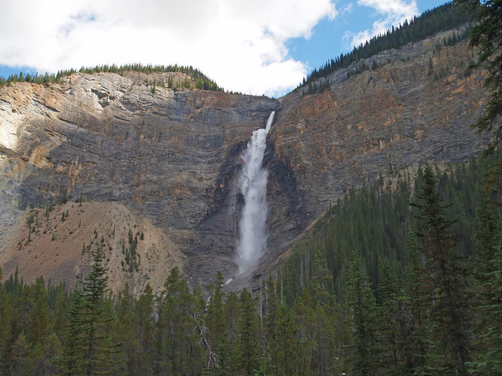
Today started out nice with clear skies and mostly sunny. Our plan is to drive back into Yoho National Park, and visit Takakkaw Falls, the Natural Bridge and Emerald Lake.
After breakfast, we walked out the door to the hotel and were met with this lovely image! It certainly looked like we were in for a nice day.
We headed out the Trans-Canada Highway and crossed into BC. It wasn’t long before we came upon the road to Takakkaw Falls. Below is a video of the final stretch of road.
We explored the area for a bit, and then walked up towards the falls.
Below is a video of the falls and the river that flows from it.
Heading back down the road, I shot this video, which clearly shows why they don’t allow trailers or RVs on this road.
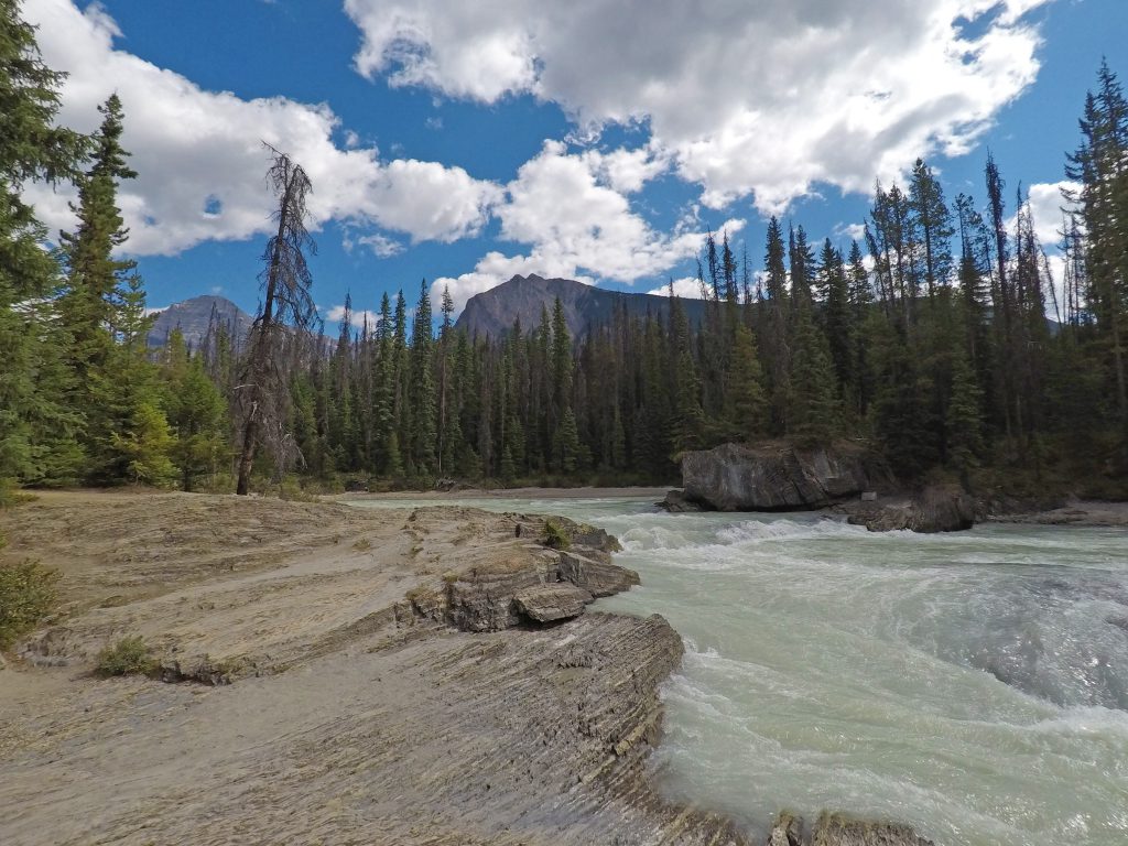
We got back on the highway, and continued west for a short distance, and came across the road to Emerald Lake. The first stop was at the Natural Bridge, which a long time ago, was once a waterfall, which has since carved a hole in the rock allowing the water to flow through the rock, creating what looks like a natural bridge.
The video below, shot from above the bridge, appears as though it is a river flowing into a large hole.
This video, shot from below the bridge, makes it clear why it’s called the Natural Bridge.
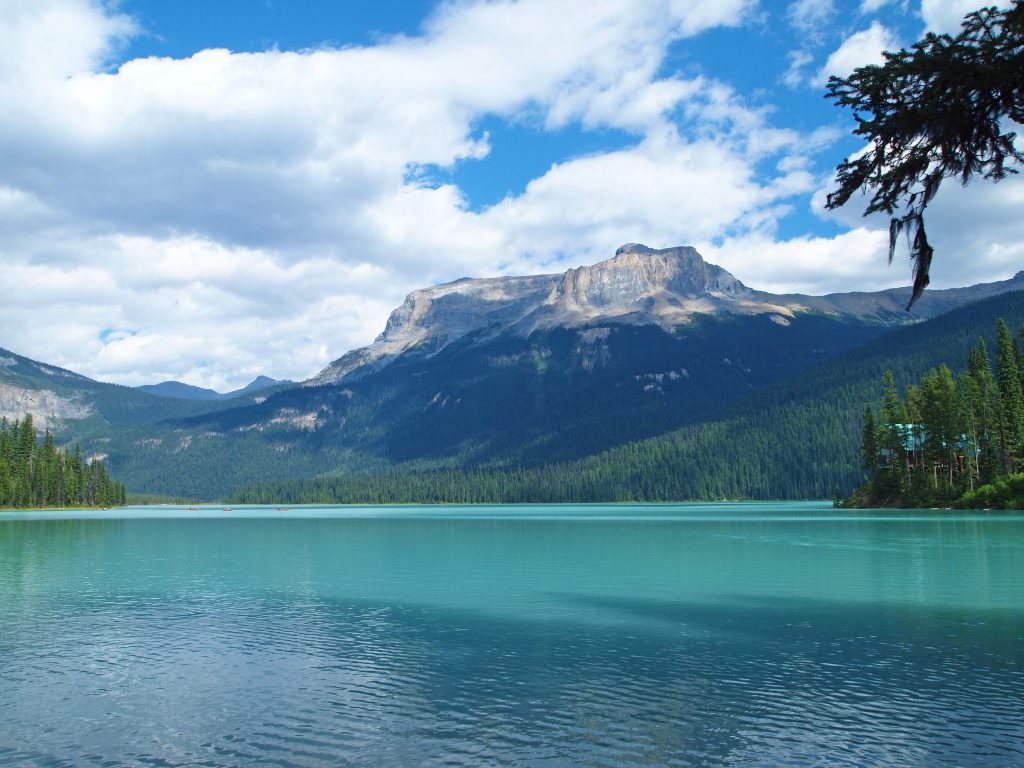
After exploring the bridge from all sides and a variety of angles, we continued up the road to Emerald Lake to have a look around. It’s no surprise why they named it “Emerald Lake”.
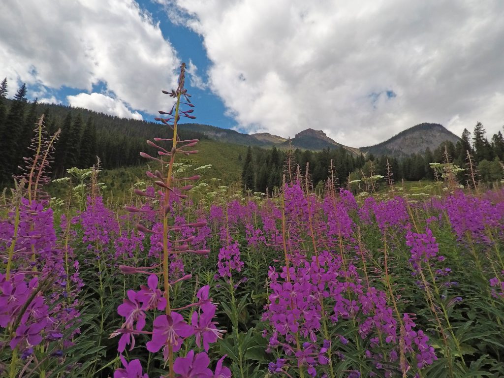
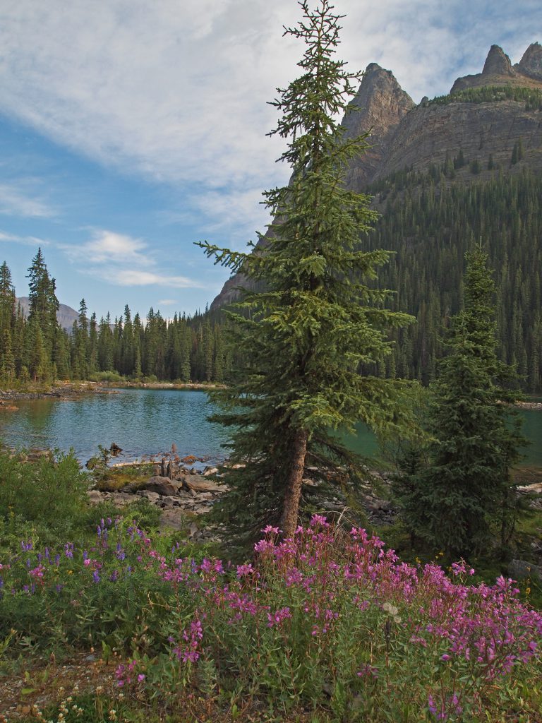
We walked around this pretty lake for a while. These purple wildflowers were very abundant.
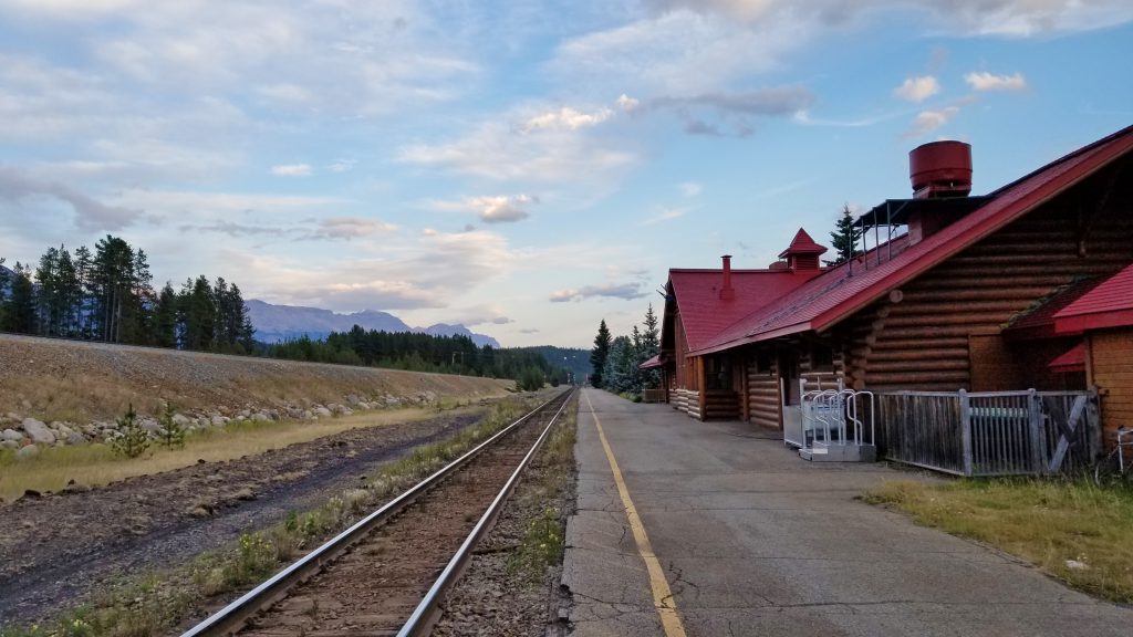
Returning to Lake Louise, we had dinner reservations at the Station Restaurant, which is one of our favourite spots to eat in Lake Louise. As the name suggests, the restaurant is in the old CP railway station.
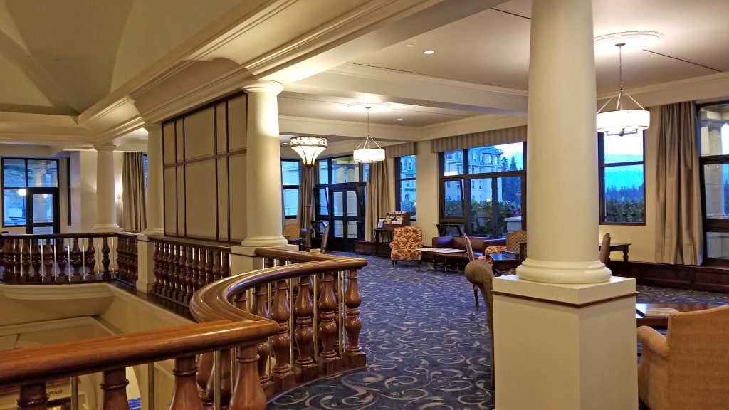
After dinner, we returned to the hotel, and enjoyed the newly renovated and under-utilized guest lounge. It’s a nice quiet place to sit and relax, with a nice view to the lobby below.
After visiting the Rockies several times, this year we are finally going to make it out to Lake O’Hara. I tried unsuccessfully to get bus tickets in the past, but this year, we managed to get two tickets for the 8:30 bus today! We awoke early, had breakfast, and left Lake Louise extra early, because we do not want to miss the bus and be disappointed for another year.
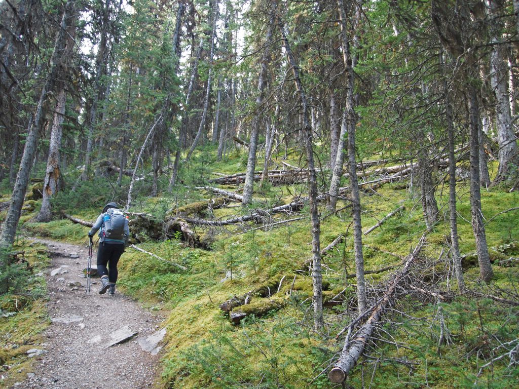
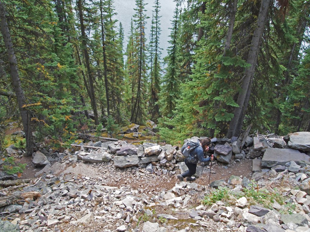
The thing about Lake O’Hara, is that it has a wonderful network of hiking trails around it. Lake O’Hara isn’t the destination, but the starting point for some excellent hikes. Anyone can walk in, but it’s 11 km, each way, up a boring old fire road through the trees. Some people who don’t secure bus tickets do make that walk, but I’d rather not spend 22 km of my day walking a road through the trees on top of the main hike. That’s how Parks Canada manages to significantly restrict access to this area, to protect the fragile area from too much human traffic. To give you an idea of what the walk up the road might be like, here is some video taken from the bus.
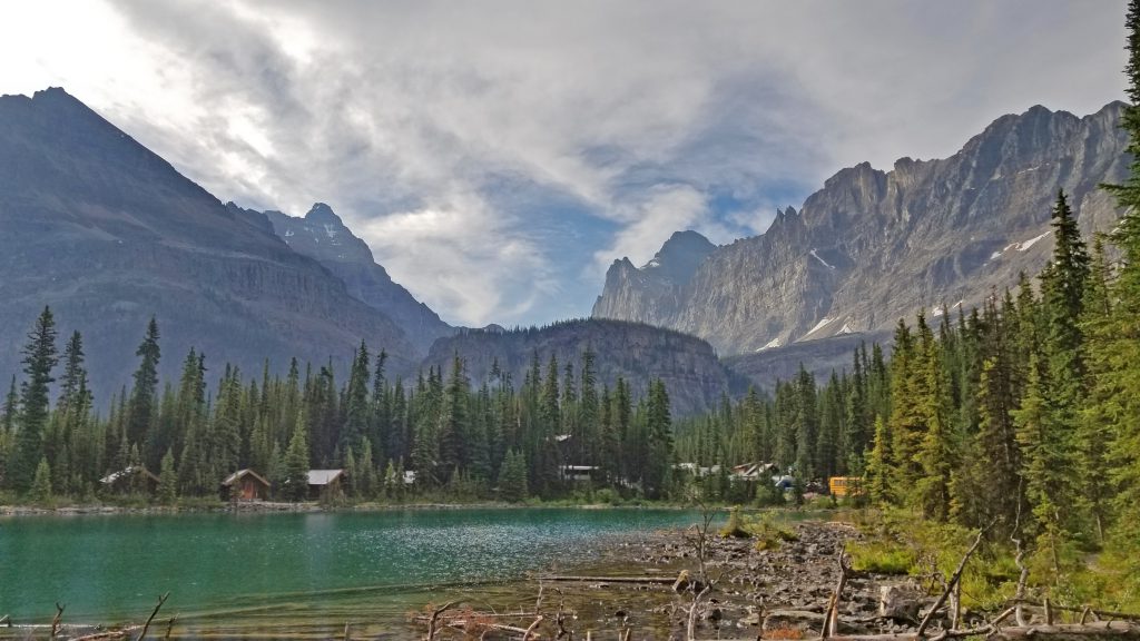
After about 20 minutes of riding a rough road in a school bus, we arrived at Lake O’Hara, dropped off in front of the Le Relais day use shelter.
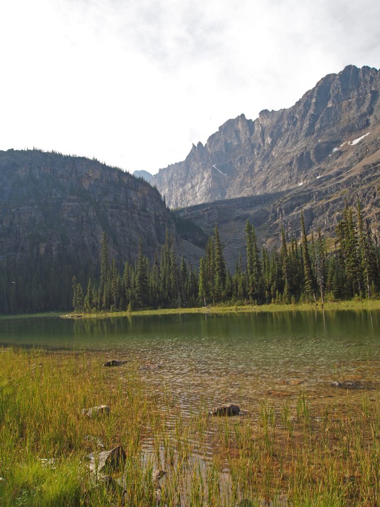
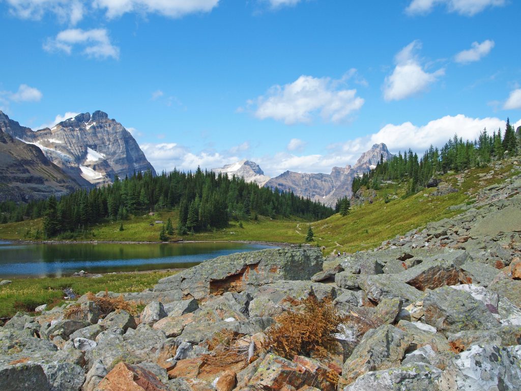
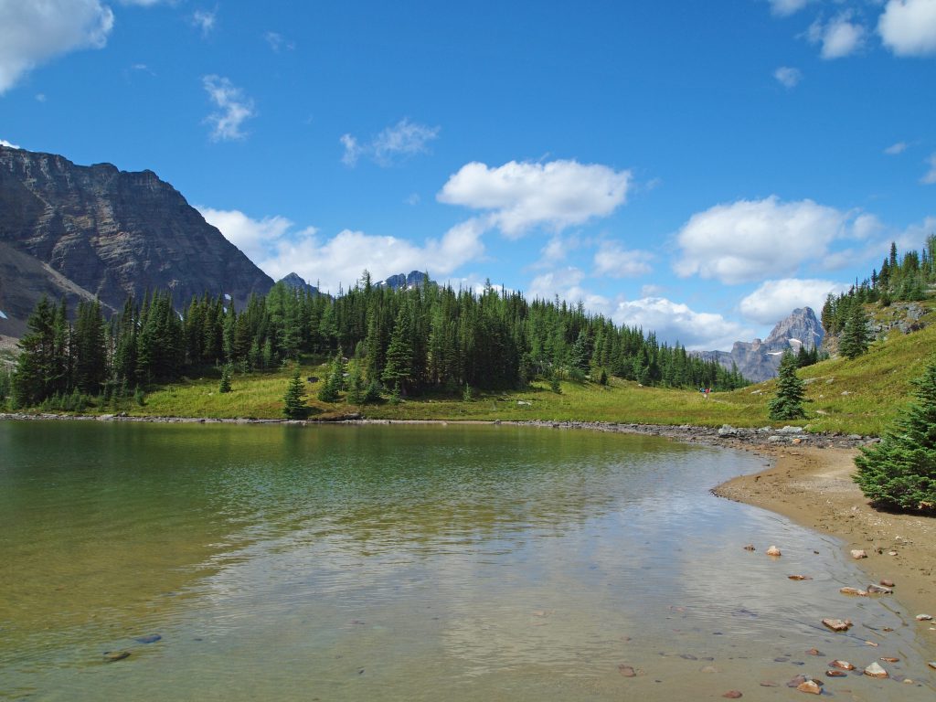
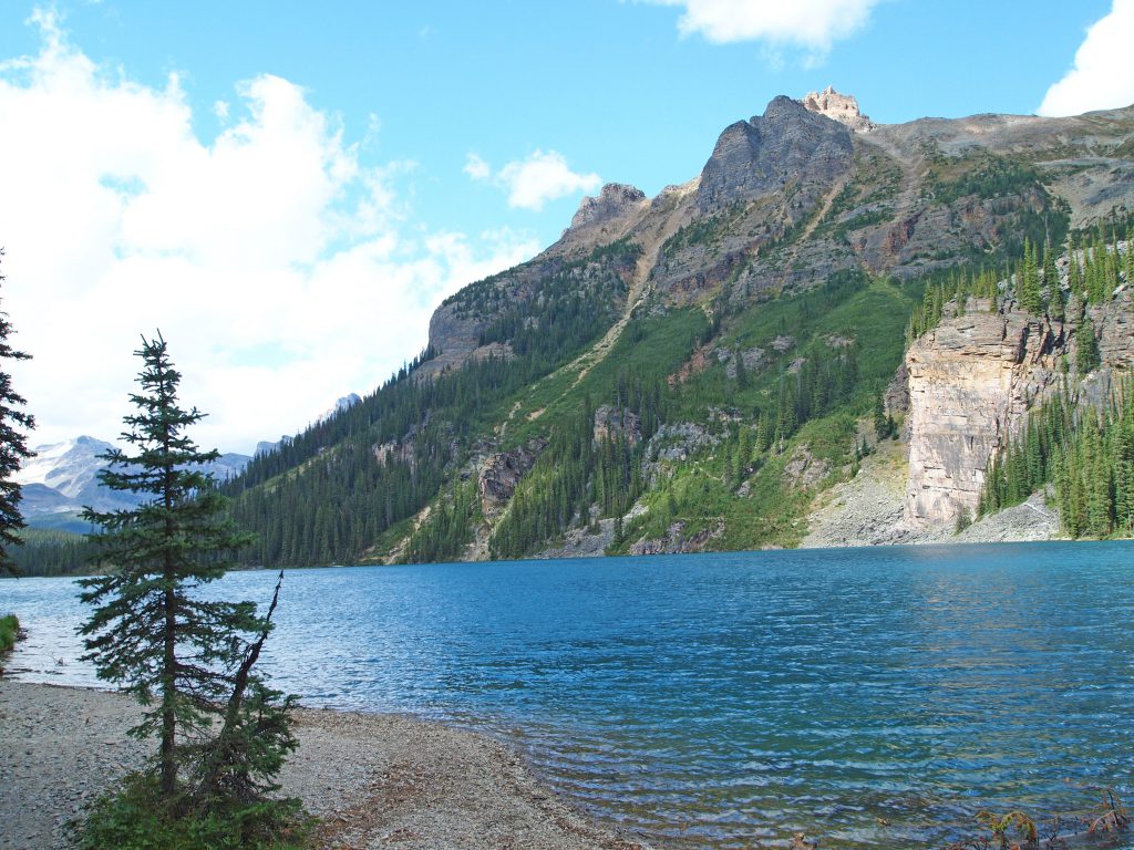
We took a few minutes to get our bearings, and headed down to the lake to have a look. It was still a bit overcast, but still looked like it would be a great day.
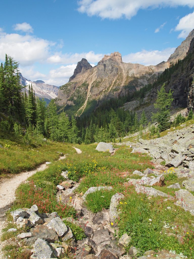
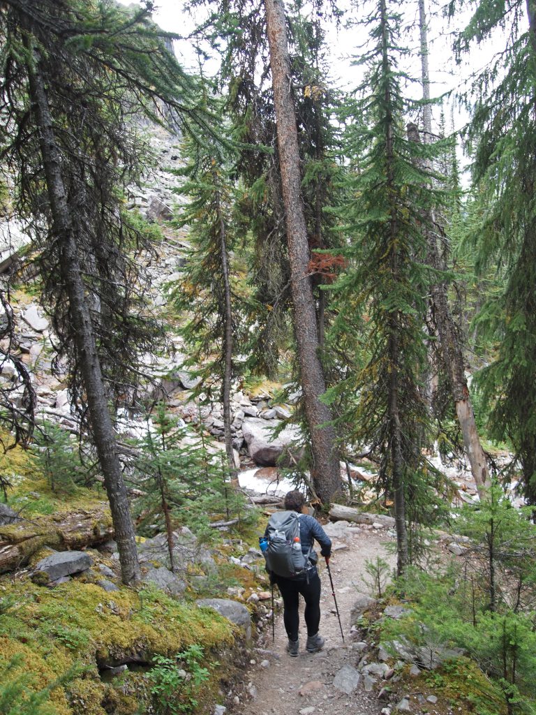
Our plan for today was to hike up to Opabin Lake, via the West Opabin Trail and return via the East. We started out by following along the Lakeshore Trail, passing the Lake O’Hara Lodge and through some nice scenery.
After a short distance, we reached a junction, and took a trail to the right that started climbing through the forest toward Mary Lake.
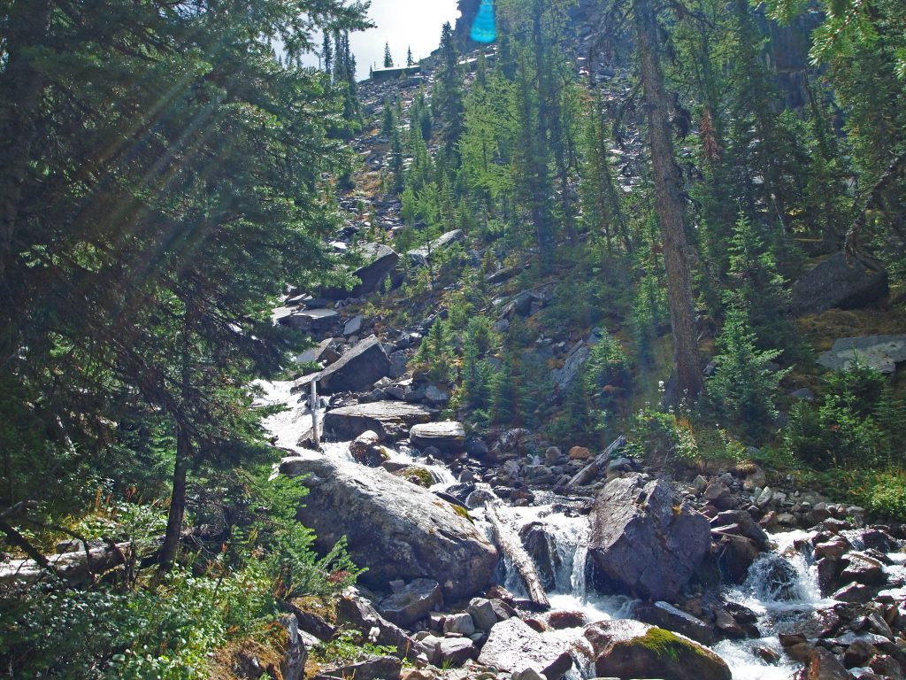
We crossed a few streams and passed a few waterfalls as we ascended quickly, and reached Mary Lake after about 1 km. Mary Lake sits about 130 feet above Lake O’Hara.
Below is a short video from the shoreline of Mary Lake.
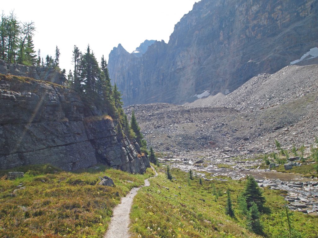
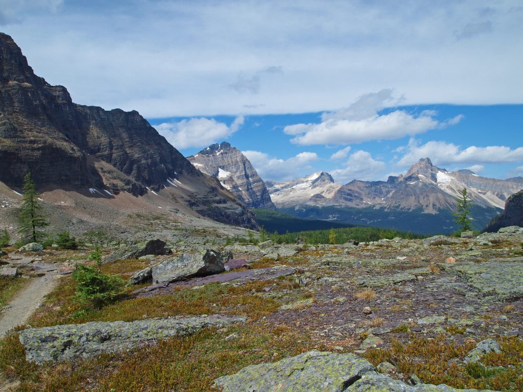
Beyond Mary Lake, it is not long before we are out of the trees. One of the great things about Lake O’Hara, is your hikes begin from an elevation where you don’t have far to go to start getting great views. You don’t have to slog it out through 500 or 750 feet of climbing to get a taste of great scenery. Here, most of your day is spent in the great scenery!
In the video below, you can see we are slightly above Mary Lake, and are about to emerge from the thinning trees.
Once out of the trees, we have a good view of the trail ahead.
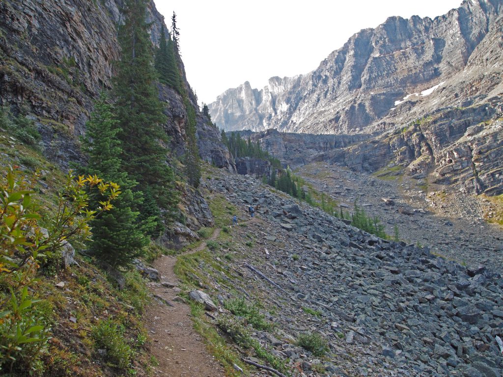
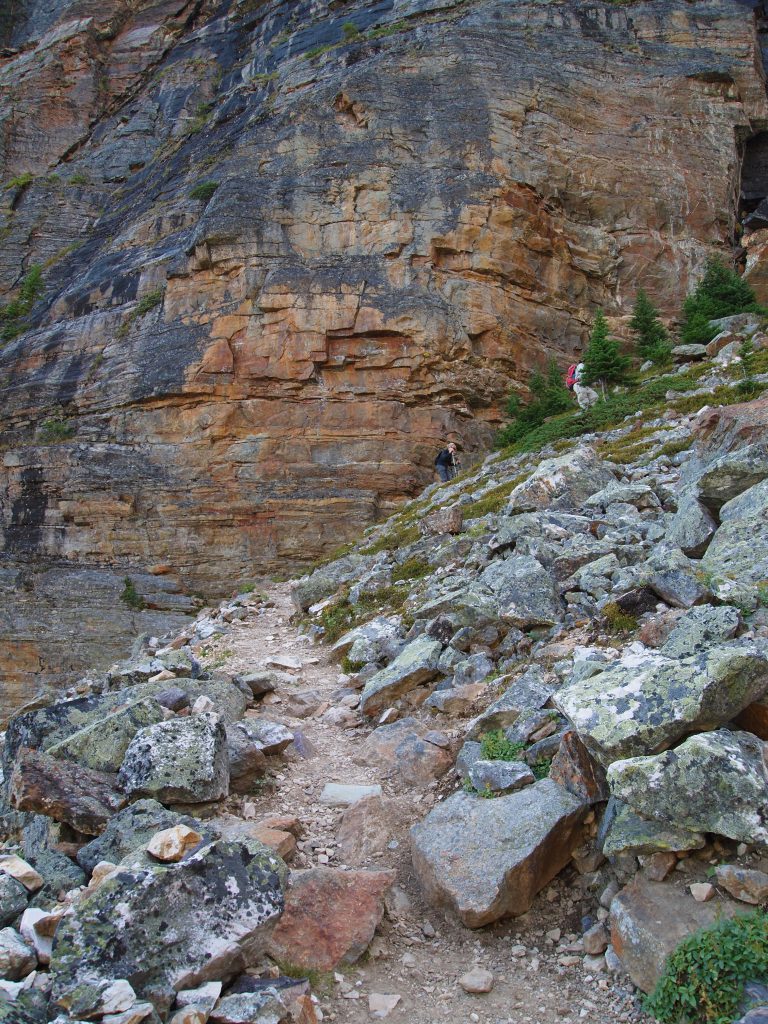
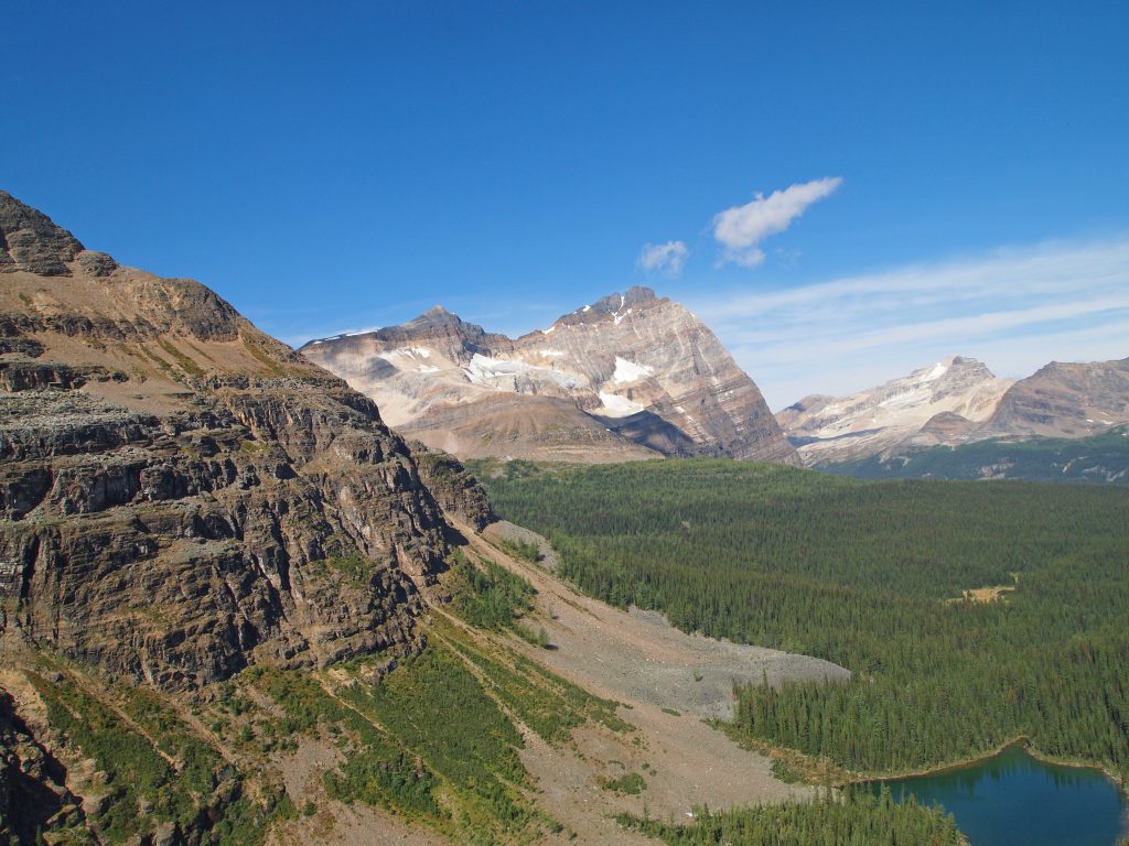
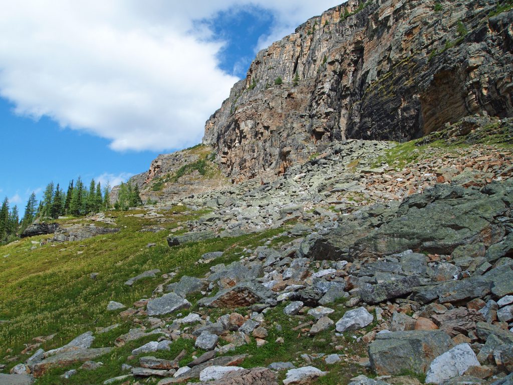
We continued climbing the trail up a rocky slope, below a rock wall that we would soon be on top of. Here are a few images taken along that trail, each shot from a slightly higher spot along the trail.
We’re now getting closer to the Opabin Plateau.
Arriving at a trail junction, we proceeded straight ahead to the Opabin Plateau. The trail to our right is the start of the All Souls Alpine route, which we will have to tackle another day.
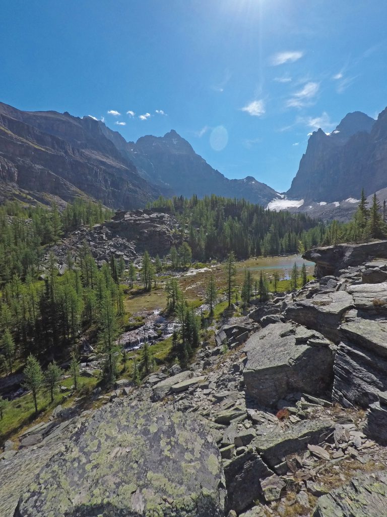
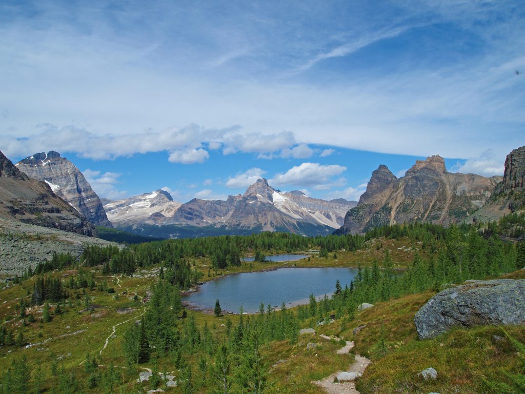
Now up on the Opabin Plateau, we’re about 210 meters or 690 feet above Lake O’Hara, and about 3.8 km into our journey.
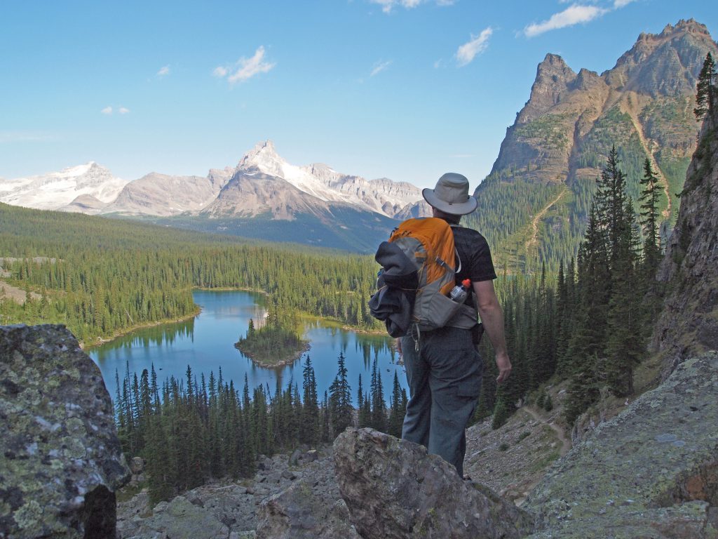
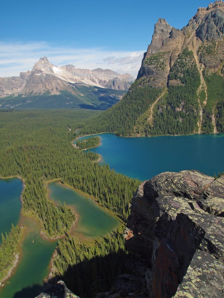
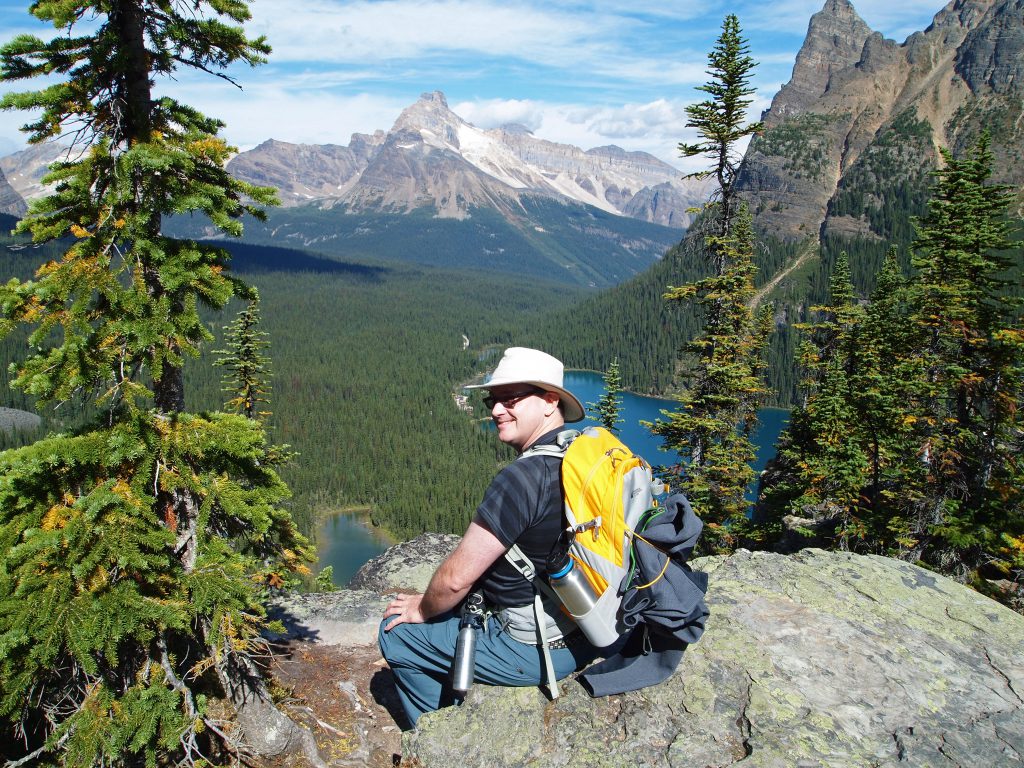
At this point, we have another trail junction. We can continue ahead on the West Opabin Trail, or take a side trip by heading back toward Opabin Prospect, which is a viewpoint on a cliff overlooking the area. The video below shows the approach and arrival and Opabin Prospect.
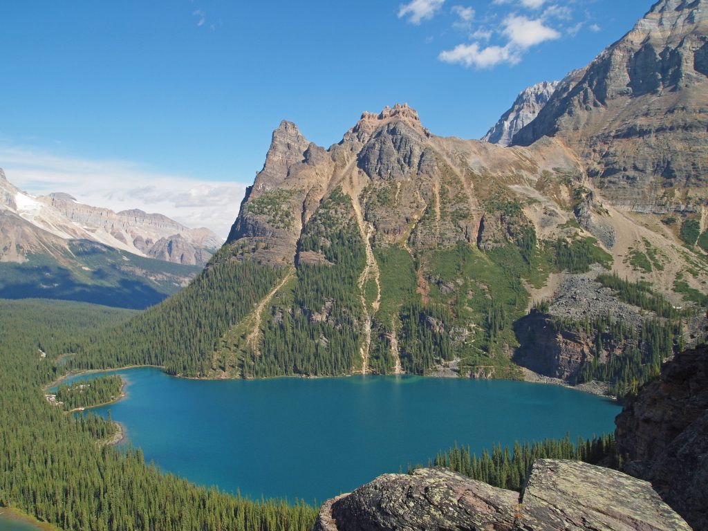
This is a view over Lake O’Hara with the alpine route to Wiwaxy Gap above.
This is a view to our left, looking toward the All Souls Alpine Route.
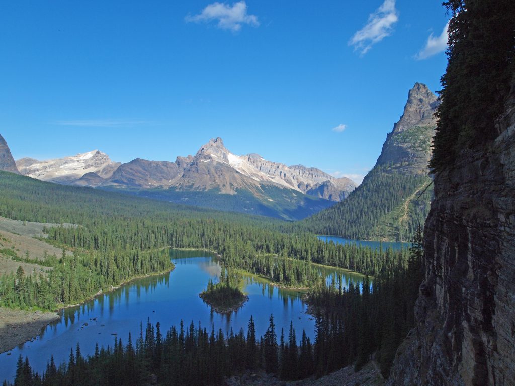
In this image we see Lake O’Hara and Mary Lake below.
As you can see, to call this spot ‘breathtaking’ would be a severe understatement. It’s so nice a spot that we decided to sit down, relax, and have a bite to eat while we take in the view.
I should also mention, that the flipside of having difficulty getting access to this glorious area, is that when you are here, you pretty much have the trails to yourself. Yes, we passed other hikers, but it is nothing like the crowds at other popular trails in the Rocky Mountain National Parks.
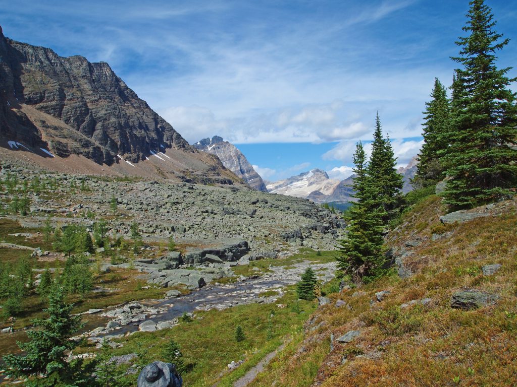
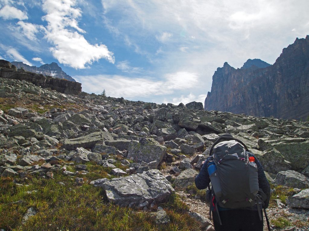
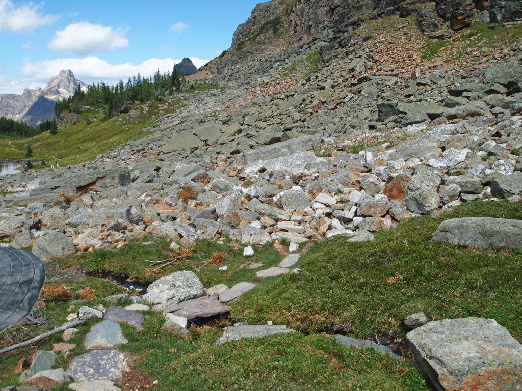
We continued heading up the Opabin Plateau, and came upon this wonderful scenery!
Below is a video of the scenery in the above two photos.
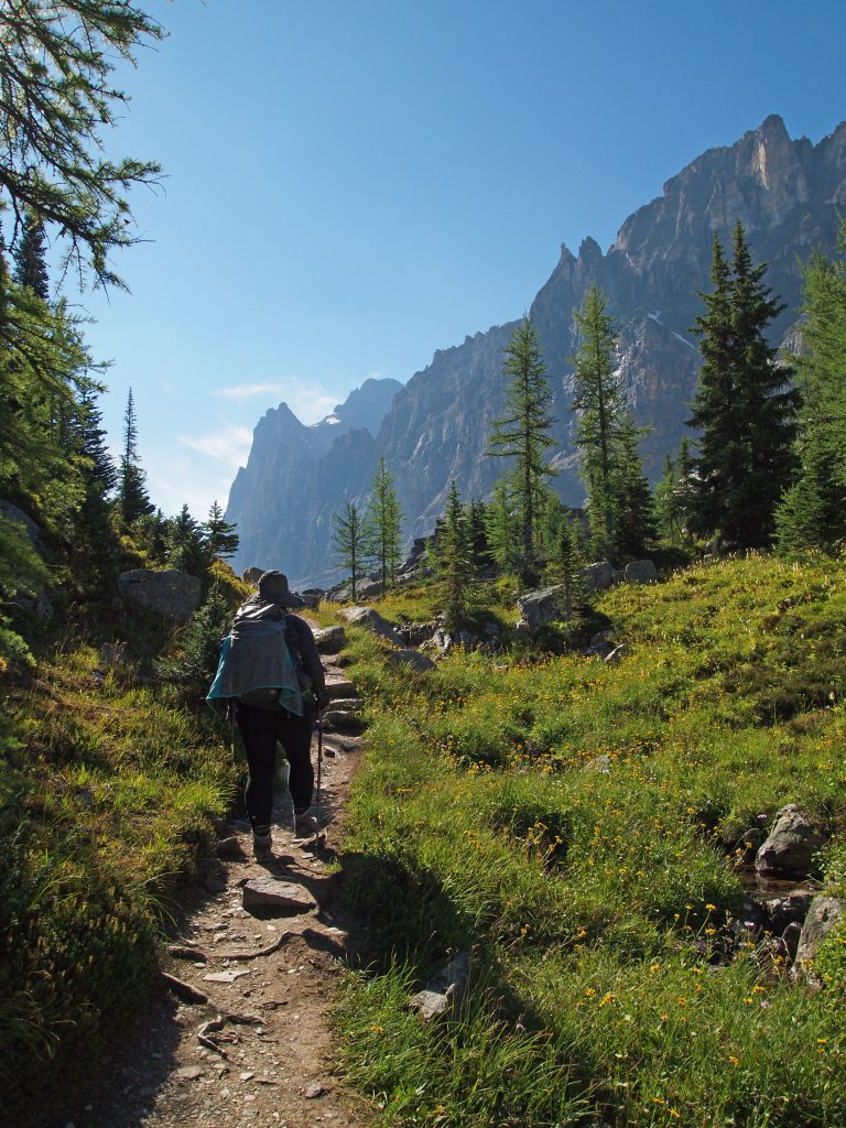
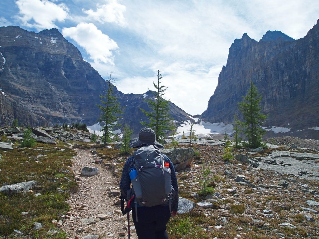
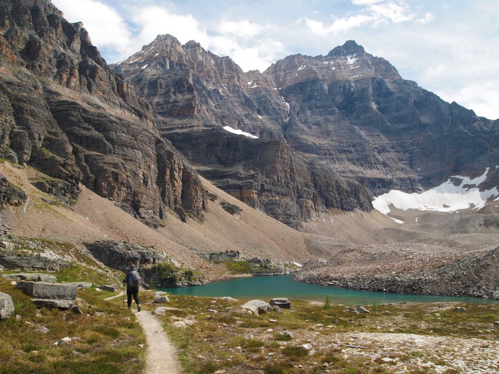
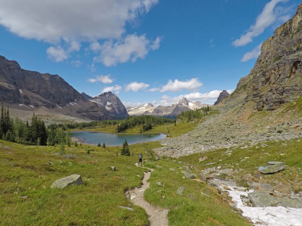
We continued hiking toward Opabin Lake up the west trail.
Nadine captured the video below as we continued along the trail.
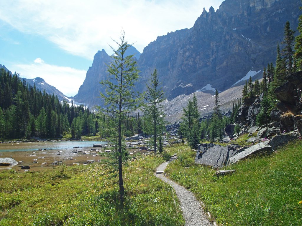
We’re starting to get closer to Opabin Lake.
It should be just beyond the top of this next section, only about 200 more feet to climb up before we should see the lake.
We paused briefly for some photos part way up the last incline.
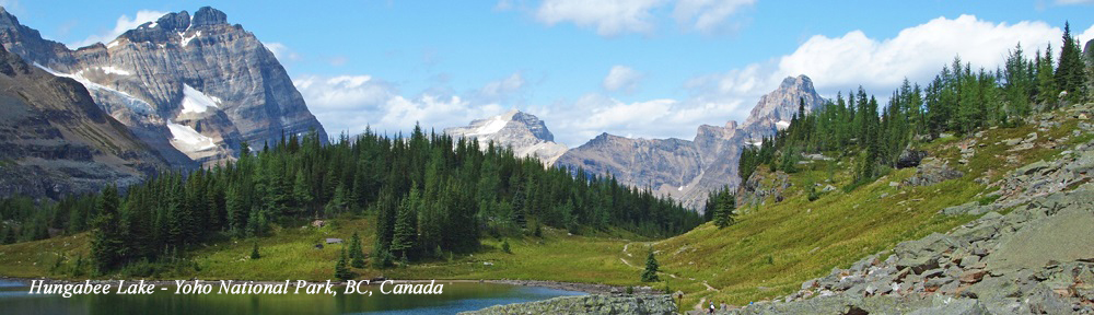
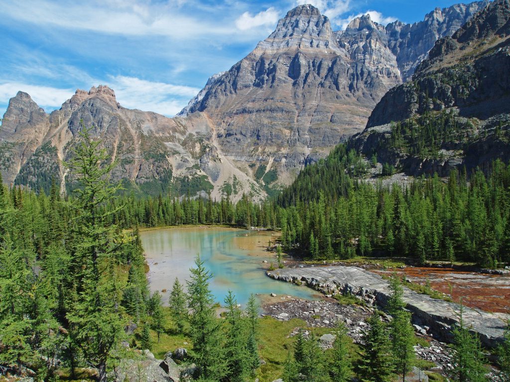
This is looking back at Hungabee Lake below us.
Just a bit further…
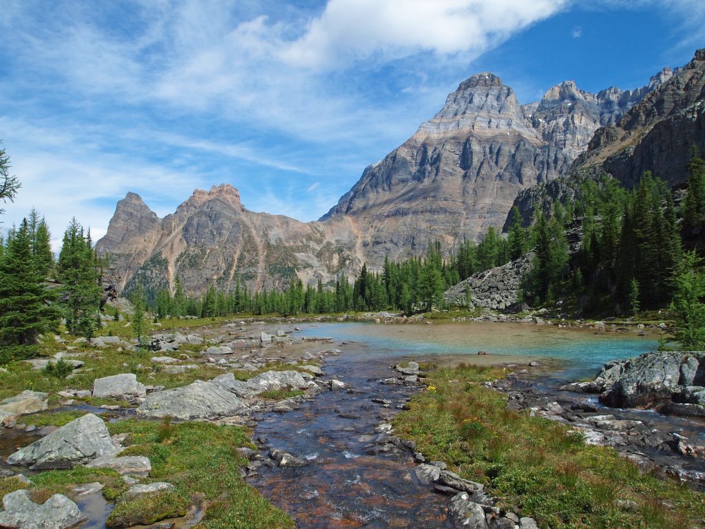
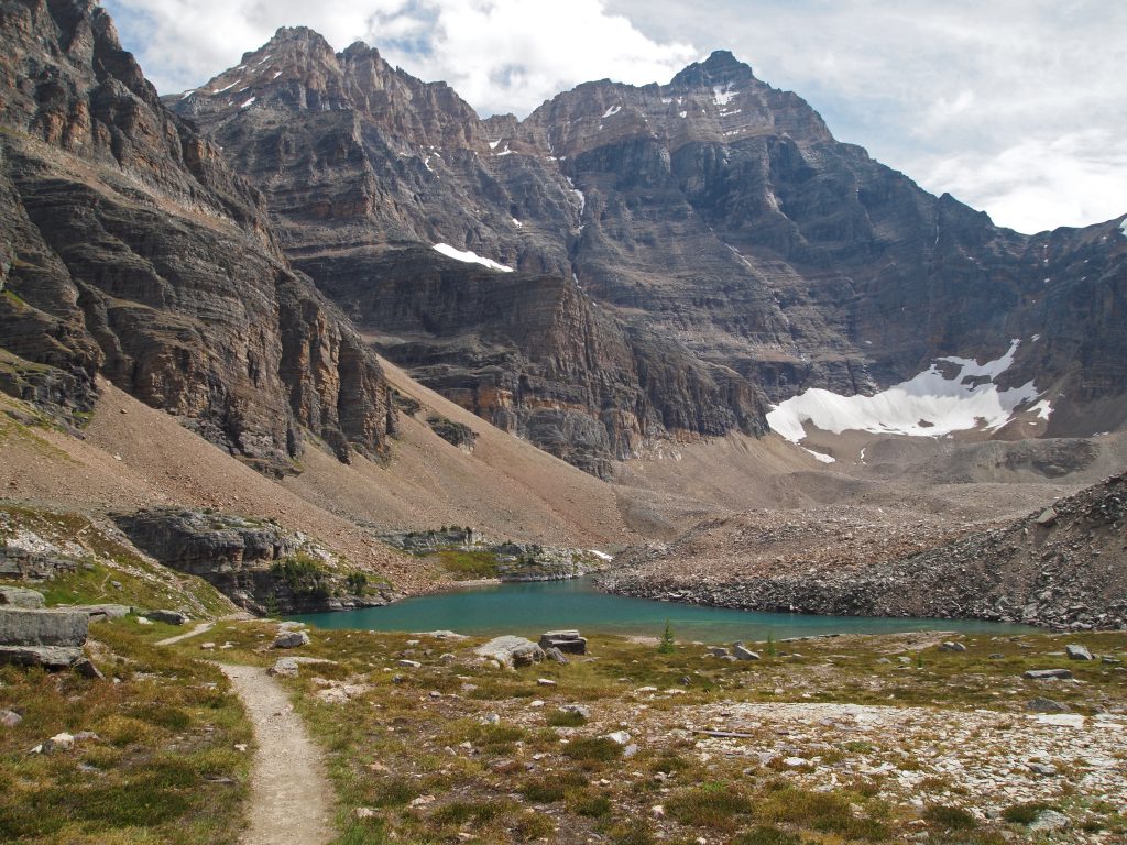
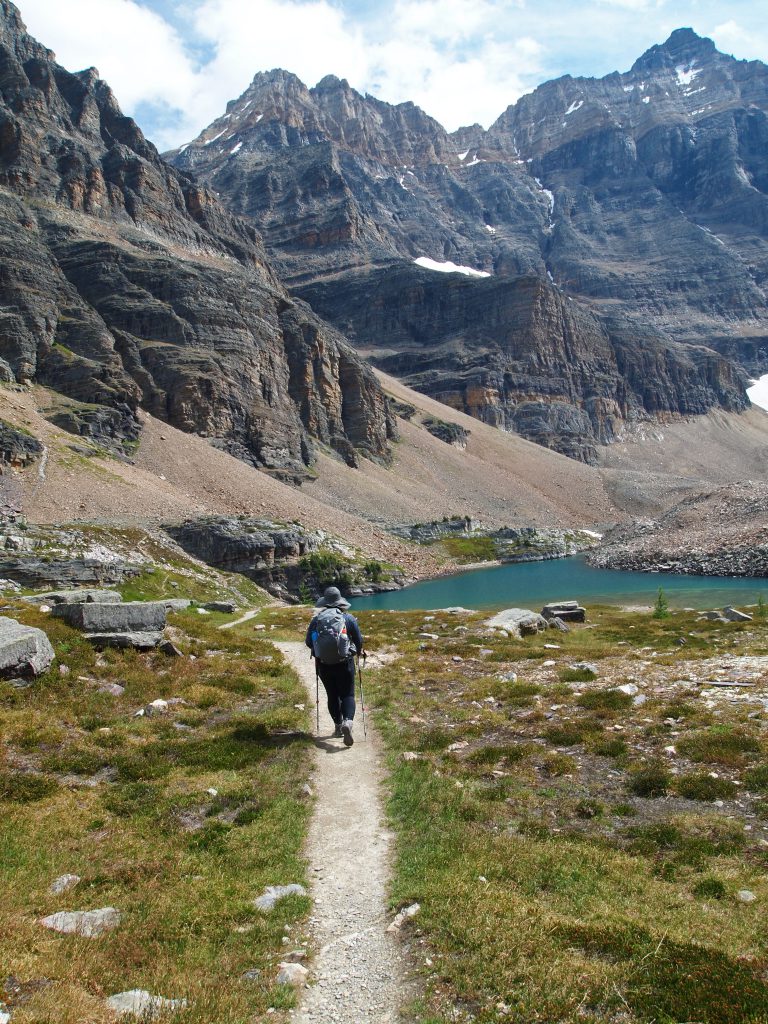
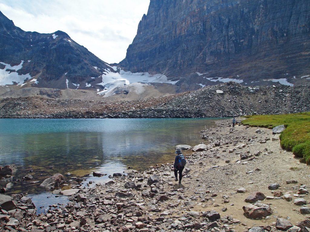
We’re now about 6.0 km into our hike, and about 900 feet above Lake O’Hara, and we get our first glimpse of Opabin Lake.
We took the opportunity to sit down on the rock by the trail, just before we descend the final stretch to the lake, to take in the view and have another snack. In the video below, you see Opabin Lake, and the glacier below Opabin Pass into the next valley.
After watching the ground squirrels for a bit, we headed down to Opabin Lake.
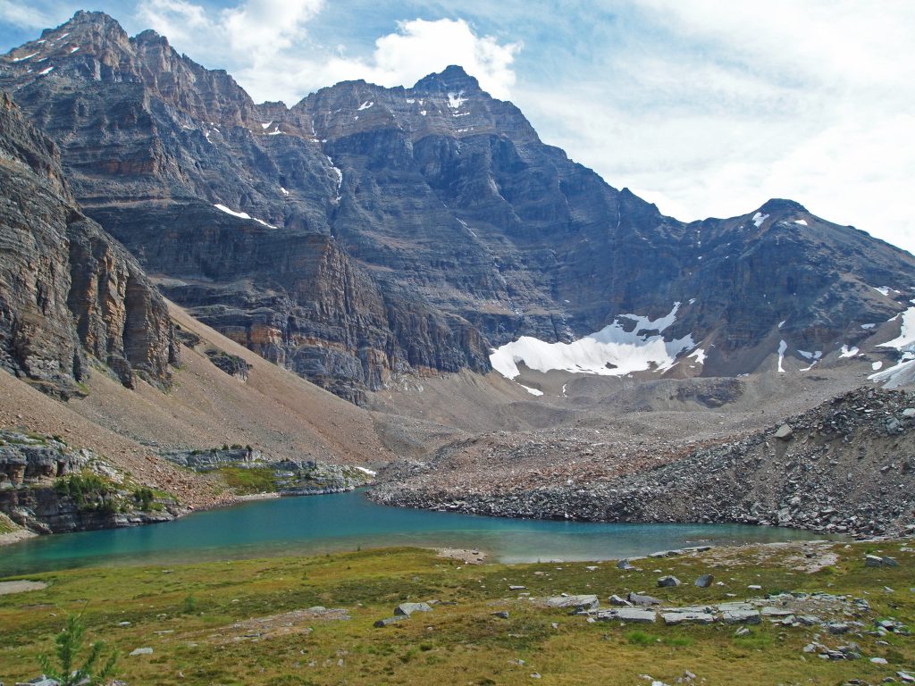
Here we are arriving at Opabin Lake.
Here at the shore of Opabin Lake, we encountered the most people we saw all day. At only about 10 people, it’s certainly not crowded when compared to popular sites in the National Parks, but it was nevertheless the most crowded place we came across all day. The family in this photo carried up a cooler, some pots and a stove! I guess they like to eat well.
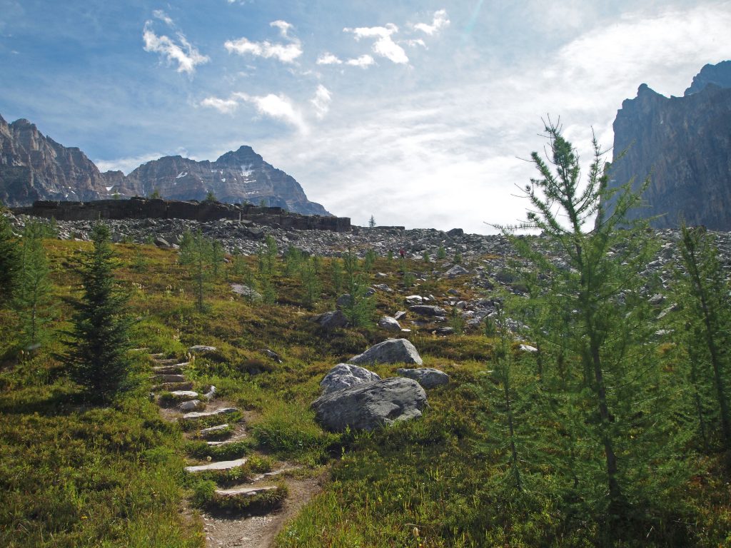
After chatting a while with the other hikers, we started our return to Lake O’Hara, but this time via the East Opabin Trail.
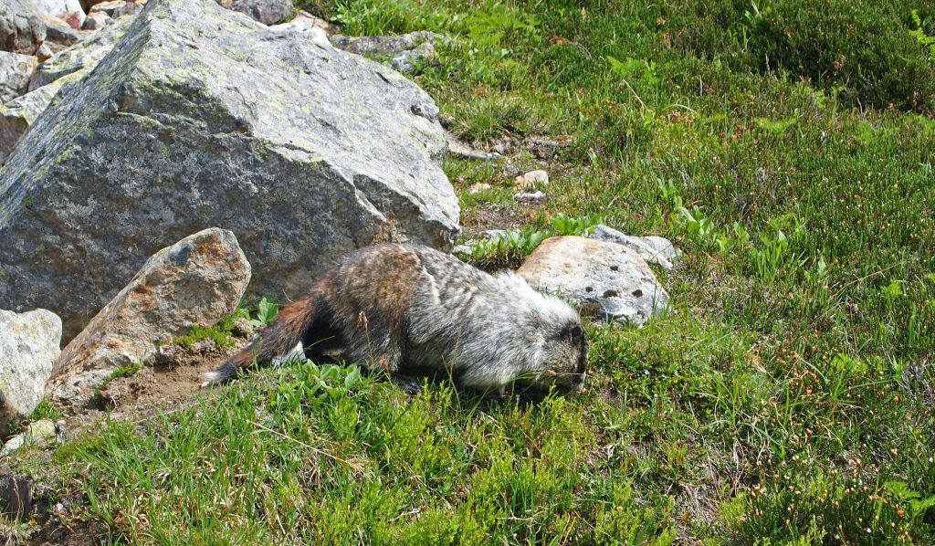
As we approached Hungabee Lake, we came across a hoary marmot on the trail.
And here is a video from where we tried to sneak by our furry friend. Instead of running off to the side, he continued into the rocks, right along the trail we were trying to follow.
Just beyond this rocky section of trail, we arrived at Hungabee Lake.
At this point, the trail splits off, and to our right, we can pick up the Yukness Ledges alpine route over to Lake Oesa. We’re going to skip that for today, as we’ve been moving a little slowly, and don’t want to risk missing the last bus out. There should be plenty of time, but we’re taking so many photos and videos along the way, we might get sidetracked. Therefore, we’ll continue down the East Opabin Trail.
We grabbed another video heading down this section. Personally, I think the West trail was more scenic, but compared to other hikes we’ve done, this is still pretty darn good!
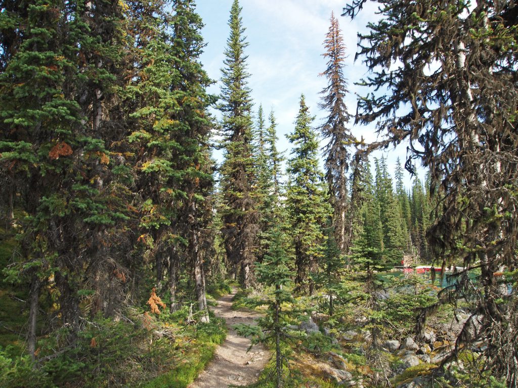
The trail entered the forest, as it descended along switch backs toward Lake O’Hara.
We passed a few waterfalls in the forest along the way.
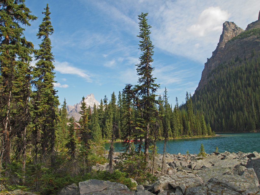
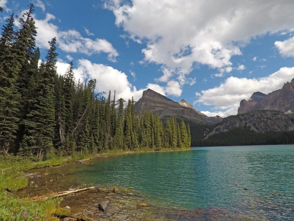
And, here we are, back at Lake O’Hara.
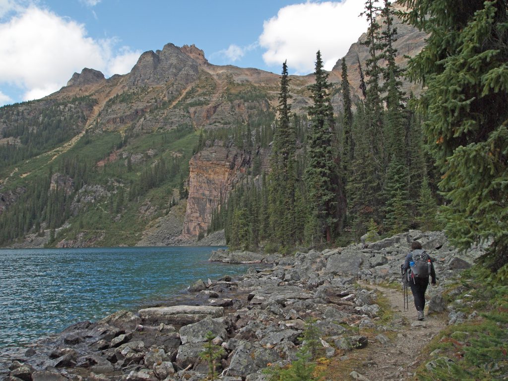
Because we still have a lot of time, we’ll take the long way around the other side of Lake O’Hara to return to the trailhead.
Here we are walking along the shoreline trail at the back of the lake.
We stopped to enjoy the view over the lake for a few minutes as we had another snack, before continuing around.
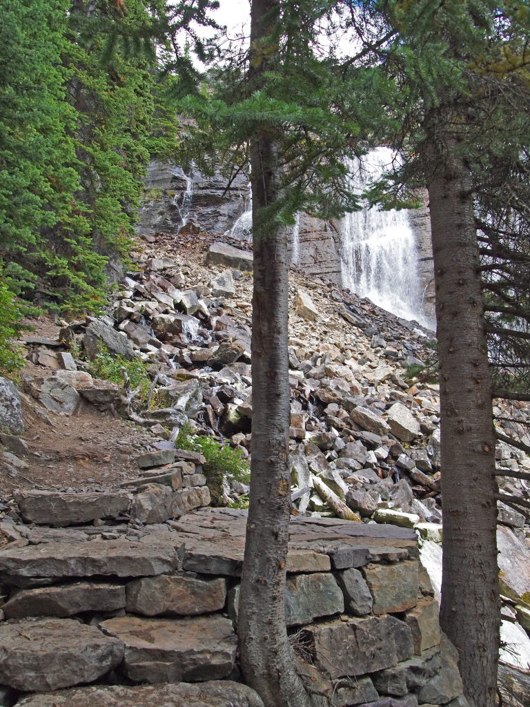
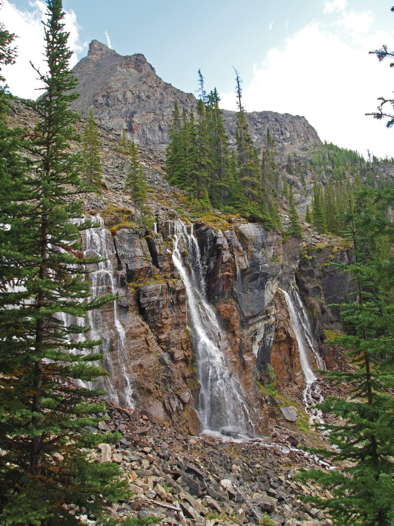
Coming across a short side trail, we decided to proceed up to the Seven Veils Falls viewpoint. It’s just a short detour, about 250 meters each way, and only about 140 feet up.
I should mention that throughout our hike, I was thoroughly impressed with the quality of the trails that were build. But the trails to this viewpoint were really something. The trails, the platforms and even benches that were constructed at this viewpoint, all by hand, and apparently all from local materials, were very impressive.
Here we are at the top viewpoint.
And after admiring both the beauty of the area and the quality of the trail building, we headed back down to the lake.
We finished our hike with a pleasant walk around the back of the lake. At this point, we ran into the only swarm of mosquitos all day!
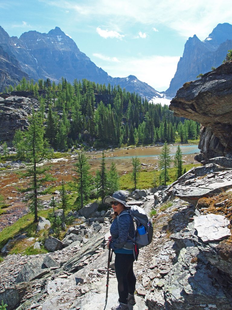
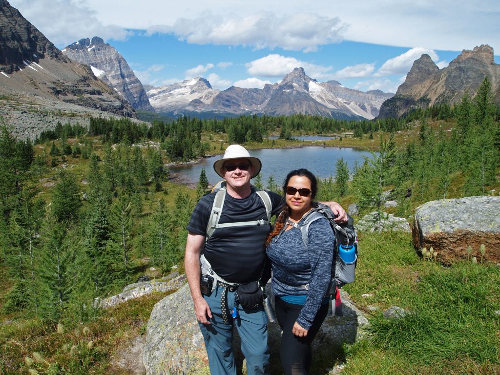
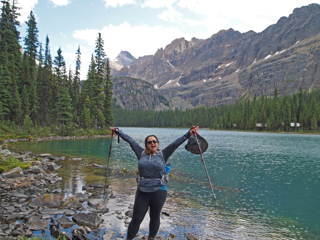
Here is Nadine, happy with our accomplishments! Behind her, you can see the Opabin Prospect in the distance.
Once back at the start, we went into the shelter to buy a slice of the fantastic carrot cake we heard about as a nice reward. We then sat by the lake while we waited for the 6:30 PM bus to load and take us out to our car. We will definitely try for a return trip to Lake O’Hara.
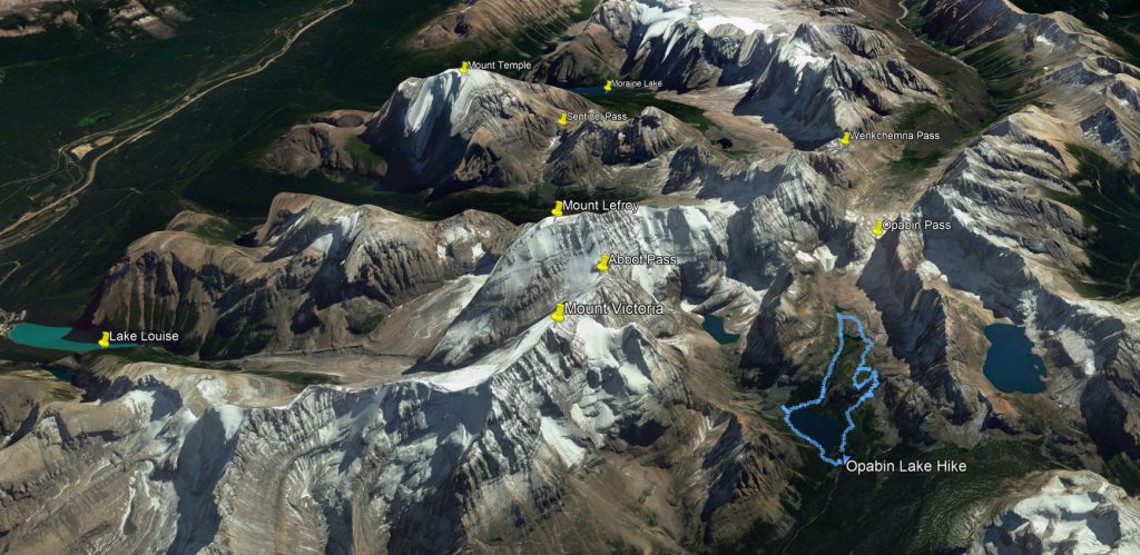
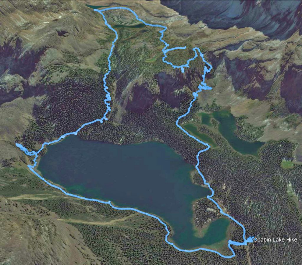
And now that we’re back, it’s time to post some maps.
For those of you who would like them, I’ve uploaded our GPS track files here for download.
Here is our track overlaid on a high level overview of the entire area.
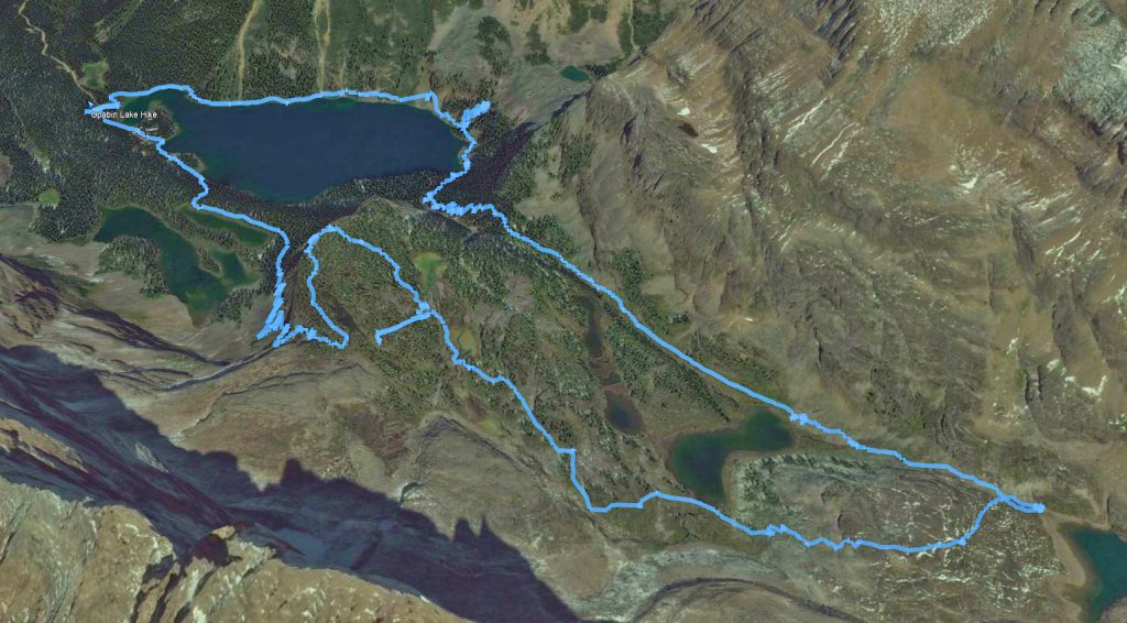
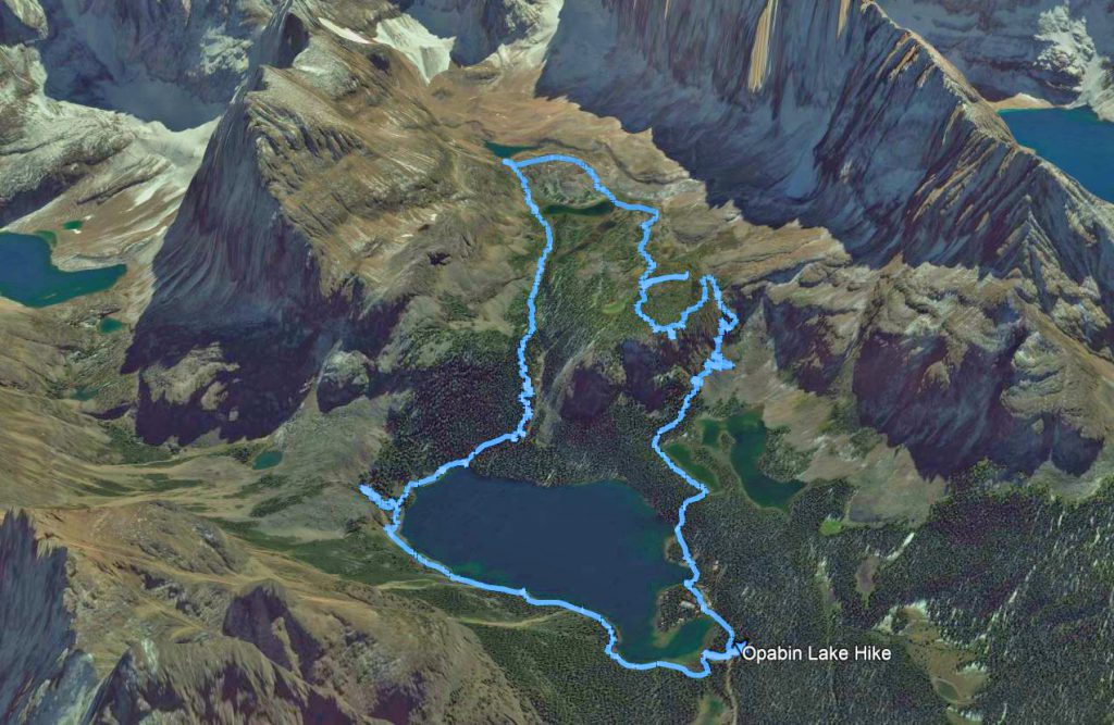
Here are a few other images with a closer view of the hike, from some different perspectives.
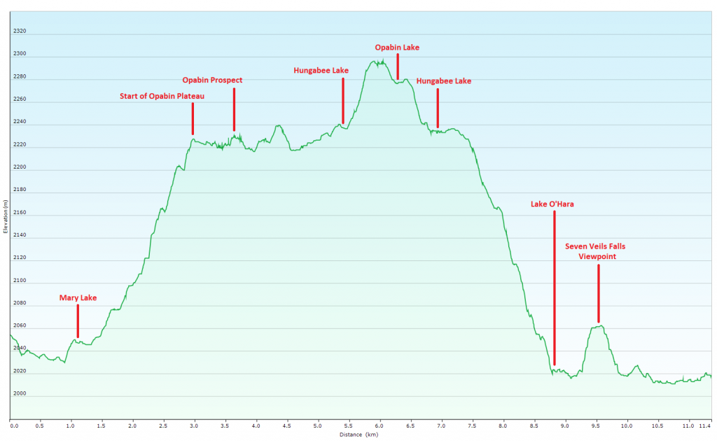
Below is an elevation plot of our hike. Please ignore the elevations at the beginning of our hike. I’m starting to realize that it seems to take my GPS a bit of time to receive an accurate fix from a cold start. For future hikes, I’ll try to remember to turn the GPS on a good 15 minutes before starting the hike. The more accurate elevation for the start of the hike, is closer to what the graph shows at the end of the hike. The track look right on the map, but the elevation for about the first 500 meters seems off.
When all was complete, our total hiking distance was 11.4 km, took a total of 4:18 of “moving time” and 3:40 of “stopped time”, which just goes to show, I take way too many photos!
Highest elevation reached was 2,297 meters (7,536 feet) just before Opabin lake, and minimum elevation was 2,017 meters (6,617 feet) at Lake O’Hara. Total elevation gain was therefore a rather modest 280 meters (919 feet). What is particularly nice about this hike, is that with only 919 feet of gain to climb, you get a lot of visual reward for the effort. Starting the hike at over 6,600 feet, we get out of the trees quickly, making this a spectacular trail.
We packed up our bags and checked out of the Banff Springs, to head up to my favourite hotel, the Chateau Lake Louise!
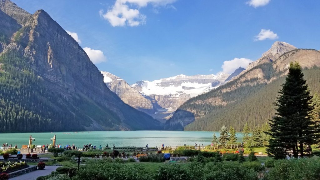
It was another hazy day as we left Banff, and took the leisurely route up the Bow Valley Parkway instead of the Trans-Canada Hwy #1. Arriving in Lake Louise, it was hazy, and the normally stunning views were a bit muted by the smoke.
We sat on the shoreline for a while, watching the busy scene unfold. There were some young girls, apparently unafraid of the cold water, swimming in the glacial lake!
Here is Nadine taking in the views.
Checking in to the hotel, we were again given our usual lake view suite. We got unpacked and ready for dinner. In all of the times we’ve stayed here, we’ve never eaten at Lago, which is the Italian restaurant at the Chateau Lake Louise. We had reservations for dinner there, and the meal was excellent, which is to be expected at this hotel.
I think this is the largest pepper grinder I’ve ever seen!
After dinner, we returned to the room to get our jackets and changed for the evening. We took the photo below from the window of our suite. It seems the smoke is starting to clear.
Nadine had signed us up for a yoga/stretching class, which seemed like a good idea to get our muscles stretched ahead of our day of hiking tomorrow. The class was offered on the canoe dock!
After our stretch class, we returned to the room to get some rest. Our plan is to be up early for a day of hiking over at Lake O’Hara.